On a clear Sunday in 1970, Peru’s tallest mountain let go. Rock and ancient ice sheared off Huascarán’s north face, pulverized into a roaring gray tide, and erased the town of Yungay in minutes. The tragedy had been foretold eight years earlier—and dismissed.
A mountain with a memory
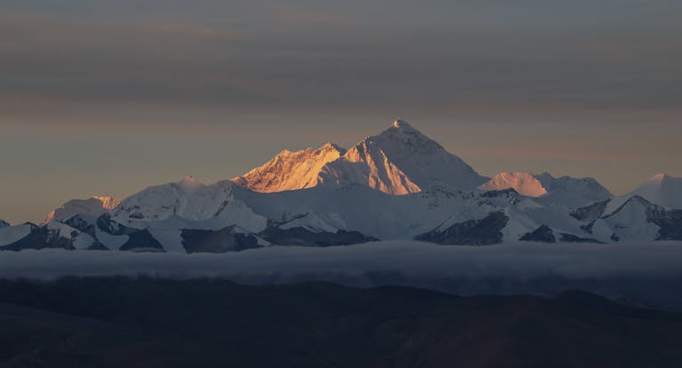
Huascarán, the 6,768-meter giant of Peru’s Cordillera Blanca, had long signaled its instability. In January 1962, a rock-and-ice avalanche tore down its slopes and struck Ranrahirca, killing thousands. A smaller slide followed in 1966. Scientists who surveyed the mountain in the aftermath warned that unstable seracs and fractured rock threatened the valley’s towns, including Yungay and Ranrahirca.
Those warnings ran into a wall of political anxiety. Local leaders worried about panic and property values; national authorities, amid a volatile decade that included military coups in 1962 and 1968, pushed back on relocation talk. Residents recall that speaking too bluntly about the risk could bring accusations of disturbing public order. Huascarán kept shedding clues. The valley stayed in place.
Forty-five seconds that changed Ancash
At about 3:23 p.m. on May 31, 1970, a powerful earthquake ruptured off Peru’s coast. The magnitude 7.9 shock rattled the Andes and triggered the catastrophe many had feared: a massive slab of rock and glacier ice peeled from Huascarán Norte and accelerated into the valley. The mass fragmented into a debris-avalanche that moved at highway speeds—far faster than a person could run—scouring everything in its path.
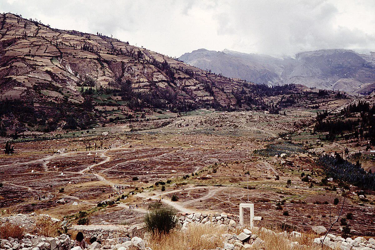
Within three to four minutes, the flow struck Yungay. Survivors describe a wall of ash-gray slurry and boulders exploding over rooftops, swallowing the plaza, and surging through orchards before re-solidifying into sunbaked cement. Of Yungay’s roughly 20,000 people, only a few hundred survived—among them children and families who sprinted toward the hillside cemetery crowned by a statue of Christ and those who happened to be on higher ground at the edge of town.
Across northern Peru, the earthquake killed an estimated 66,000 to 70,000 people and left hundreds of thousands homeless. But it was the annihilation of Yungay—buried under meters of rock and ice—that seared itself into national memory. Today, the original town site is a national cemetery. Trunks of palm trees still jut from the earth, and the statue on the cemetery hill looks out over the empty grid of streets that once bustled with markets and children walking to school.
What the warnings were trying to say
In the 1960s, geologists and mountaineers had described a chain of hazards: fractured bedrock, oversteepened glacier faces, and narrow gullies that could funnel any collapse straight toward population centers. Avalanche physics in the high tropics is unforgiving. When rock fails, it can entrain ice and snow, increasing volume and momentum; as the mass pulverizes, it behaves like a fluid, riding on a cushion of trapped air until it outruns the valley floor.
None of this was unknowable in 1970. The region had endured deadly floods from glacial lakes earlier in the century, prompting early engineering works on some lagoons. After 1962, several experts urged mapping of no-build zones and relocation of the most exposed neighborhoods. The message was clear: a rare but devastating runout could happen again. The choice was to move first—or be moved by the mountain.
When institutions look away
The Huascarán disaster was not an anomaly of nature alone; it was also a failure of governance. Officials feared the economic and political costs of sounding the alarm. Residents placed understandable faith in normalcy, especially after years without incident. Between those pressures, the valley’s risk became a tolerated background fact—until the ground shook.
Elsewhere, similar dynamics have had harrowing consequences. In 1966, in the Welsh village of Aberfan, a coal spoil tip liquefied after heavy rain and engulfed a school, killing 144 people—116 of them children. A public tribunal later issued a verdict that reads like a warning label for every risk-prone community:
“The Aberfan disaster could and should have been prevented … [It tells] not of wickedness but of ignorance, ineptitude and a failure in communications.”
The echoes are unmistakable. Whether on a Welsh hillside or beneath a Peruvian peak, silence about known danger compounds catastrophe.
After the avalanche: what changed in Peru
In the wake of 1970, Peru reshaped its relationship with the high Andes. Authorities relocated survivors to New Yungay, set aside the buried town as a sacred site, and expanded hazard programs in the Cordillera Blanca. A glaciology and water-resources unit grew into a permanent capability, monitoring glacier fronts and reinforcing or lowering glacial lakes. Huascarán National Park, established in 1975 and later recognized by UNESCO, placed conservation boundaries around some of the most fragile headwaters on Earth.
Risk mapping has improved since the 1970s, but the region’s exposure is evolving. As tropical glaciers retreat, steep, newly deglaciated slopes and young lakes can become unstable—a paraglacial hazard regime. The lesson of Yungay is not simply to watch the ice. It is to plan the valley as if the mountain will fail again one day, because in geological time it will.
Lessons written in stone and ice
Disasters like Huascarán’s avalanche are born long before the moment of collapse. They begin in the gap between what experts can see and what communities are prepared to do. Closing that gap is as much about trust and governance as it is about geology.
- Listen early and act on hazard maps: designate no-build zones and enforce them, even when it is unpopular.
- Invest in monitoring and drills: sensors, sirens, and regular evacuation practice save minutes that mean lives.
- Plan relocations with dignity: offer livelihoods, services, and clear timelines so people can choose safety before disaster forces it.
- Make risk communication a public service: speak plainly about low-probability, high-consequence events—and don’t punish the messengers.